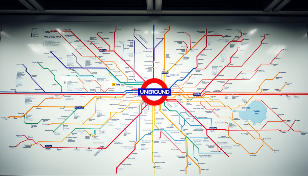
London Underground Map PDF – Free Official TfL Downloads
Finding the right London Underground map PDF for your needs can make navigating the city considerably easier. Transport for London offers several official versions available for free download, each designed for different purposes and accessibility requirements. Whether you need a standard overview, a large print version, or detailed step-free access information, knowing which file to choose saves time and ensures you have the most current information.
The official TfL maps cover all London Underground lines, the Elizabeth line, London Overground, DLR, and trams in a single document. These PDFs are updated periodically to reflect service changes, new lines, and accessibility improvements. Visitors and residents alike can benefit from downloading these resources before traveling or keeping copies on their devices for offline reference.
This guide walks through the available options, their key features, and how to access them directly from TfL’s official channels.
Where to Download the London Underground Map PDF for Free?
TfL provides free PDF downloads of their official tube maps through their website. The primary hub for all map variants is available at tfl.gov.uk/maps/track/tube. Each version serves a specific purpose, so understanding the differences helps in selecting the most appropriate download.
3.09 MB · Includes all lines and Elizabeth line
3.51 MB · Accessibility-focused design
3.54 MB · Detailed accessibility info
445 KB · High contrast option
The standard Tube map PDF serves as the primary download for most users. This comprehensive document shows all Underground lines, the Elizabeth line, London Overground, DLR services, and tram connections across Greater London.
Key Insights About Official TfL Maps
- The standard map is updated regularly, with the most recent edition dated March 2026 (TfL 0599.03.26)
- All official maps include the Elizabeth line as a distinct service
- Night Tube services are clearly marked where available
- Some lines feature air-conditioned trains, noted on the map (including Lioness and Liberty lines)
- Maps indicate fare zones for ticket pricing reference
- Step-free access stations are highlighted in dedicated guides rather than the main map
- All TfL PDFs are designated for personal use only
Official TfL maps are updated throughout the year, with print versions produced in May and December. Always verify you’re downloading the most recent version from the official TfL website rather than relying on cached or archived copies.
Official Map Versions at a Glance
| Map Type | File Size | Source | Key Features |
|---|---|---|---|
| Standard Tube Map | 3.09 MB | TfL | All lines, Elizabeth line, Night services |
| Large Print Colour | 3.51 MB | TfL | Accessibility design, fare info, step-free links |
| Large Print B&W | 445 KB | TfL | High contrast, print-friendly |
| Step-Free Guide | 3.54 MB | TfL | Street to platform access details |
| Visitor Tube Map | ~3.4 MB | VisitLondon | Tourist-friendly, zones highlighted |
| Easy Tube Map | Varies | easytubemap.com | Alternative layout, multiple versions |
London Tube Map Large PDF and Accessible Versions
For users requiring larger text and clearer visuals, TfL publishes dedicated large print versions of their tube maps. These accessibility-focused documents are available in both colour and black-and-white formats, designed to meet various visual needs.
Large Print Colour Map
The large print colour version measures 3.51 MB and was last updated in October 2025. This version maintains the standard map’s information while featuring increased text sizes and higher contrast elements that make reading easier for people with visual impairments or those using the map in challenging lighting conditions.
The colour version proves particularly useful for distinguishing between different tube lines, as the colour-coding remains intact while being presented in a more pronounced format. It includes fare zone information and direct links to step-free access guides for passengers requiring mobility assistance.
Black and White Large Print Map
The black and white large print alternative offers a 445 KB file size, making it significantly smaller and faster to download. This version relies on line patterns and symbols rather than colour to differentiate between services, which some users find easier to interpret.
The step-free Tube guide, updated January 2026, provides comprehensive details about stations with step-free access from street to platform across the Tube network, Elizabeth line, DLR, London Overground, trams, and Thameslink services. This guide is updated online throughout the year and printed twice annually in May and December.
Choosing the Right Accessibility Map
Selecting between the colour and black-and-white versions depends largely on individual preferences and visual requirements. The colour version offers more intuitive line differentiation, while the black-and-white version provides consistent contrast regardless of print quality or display settings. Both versions maintain the same underlying information, including all stations, interchange points, and service notes.
Latest London Tube Map Including 2026 Updates PDF
The most current standard Tube map carries a March 2026 edition date (TfL 0599.03.26), reflecting TfL’s commitment to keeping public transport information current. This version incorporates all existing lines including the established Elizabeth line services, which have been fully integrated into the network since their opening phases.
What’s Included in Current Editions
Recent editions of the London Underground map include several notable features. The Elizabeth line appears as a distinct service connecting Reading and Heathrow in the west to Shenfield and Abbey Wood in the east, passing through central London via new and existing infrastructure. Night Tube services continue to operate on specific lines, with their routes clearly marked for late-night travelers.
Additional service notes on the map highlight lines equipped with air-conditioned trains. The Lioness line, serving the Watford area, and the Liberty line, serving Romford via Upminster, both feature climate-controlled carriages according to current TfL information.
While the standard map and step-free guide carry recent 2026 edition dates, no major 2026-specific alterations such as new line extensions are detailed in current maps. For real-time service status and any unplanned changes, TfL recommends using tfl.gov.uk/plan-a-journey or the TfL Go app.
Map Update Timeline
Understanding when maps are updated helps ensure you’re working with current information. TfL maintains a schedule of periodic releases alongside online updates that occur throughout the year.
- 2021-2022: Elizabeth line phases opened, integrated into standard maps
- May and December: Printed step-free guide editions released
- October 2025: Large print colour map last updated
- January 2026: Step-free guide updated with current accessibility information
- March 2026: Standard Tube map most recent edition
London Underground Map PDF Alternatives Like Google Maps
While official TfL PDFs remain the authoritative source for tube map information, several alternatives exist for users preferring digital or interactive formats. Understanding what these alternatives offer helps in selecting the most suitable option for specific travel needs.
Third-Party PDF Options
Websites such as easytubemap.com provide alternative map layouts including easy-to-read versions, legacy formats, and rush hour variations. These maps, dating from July 2025, feature new Overground line groupings but are not affiliated with TfL directly.
Various archives host older TfL PDFs, with some dating back to 2011. While these may serve historical or reference purposes, TfL recommends downloading current versions from their official channels to ensure accuracy. Third-party archives include resources from civicobserver.co.uk, space-institute.org, and sucs.org.
Visitor and Tourism Resources
Tourism-oriented sites like VisitLondon.com maintain their own tube map versions, typically showing zones and key landmarks useful for visitors. These resources, often carrying 2023 or 2025 dates, focus on tourist-relevant information and carry personal-use restrictions.
The VisitBritain Shop also hosts older TfL maps with zone overlays, though these should be verified against current TfL sources before relying on them for planning purposes.
For interactive planning with real-time updates, TfL recommends their official Go app, which integrates maps with live departure information and accessibility tools. This provides a dynamic alternative to static PDFs for users with smartphone access.
Commercial and Licensing Considerations
All official TfL PDFs carry personal use restrictions in their footer information. Organizations requiring maps for commercial purposes, including business publications, marketing materials, or educational resources, should consult tfl.gov.uk/maplicensing for licensing arrangements and authorization requirements.
What Information Is Verified Versus Uncertain?
Transparency about what is confirmed versus what remains unverified helps readers assess the reliability of information presented. Several aspects of London Underground mapping can be stated with confidence, while others require qualification.
- Official TfL PDFs from tfl.gov.uk/maps/track/tube are the authoritative source
- Standard map March 2026 edition is current
- Step-free guide January 2026 edition is current
- Large print colour October 2025 is most recent accessibility version
- All maps include Elizabeth line
- Personal use restrictions apply to official PDFs
- Third-party map dates should be confirmed against TfL sources
- Archive sources like space-institute.org may contain outdated editions
- Future 2026 map changes not yet published
- Night Tube operating hours subject to change
- Air-conditioned line designations may be updated
Direct TfL downloads remain the preferred source for currency and accuracy. When using third-party resources, verification against official TfL channels is advisable, particularly for planning purposes where outdated information could cause inconvenience.
Understanding TfL’s Official Map Coverage
TfL’s official tube maps project a comprehensive view of London’s public transport network. The standard Tube map includes all eleven Underground lines, each distinguished by colour and name, alongside the Elizabeth line, London Overground, DLR services, and tram connections. This integrated approach helps passengers understand how different transport modes connect across the city.
The Elizabeth line occupies a distinctive position, shown as both a tube line and a mainline railway service depending on context. It connects with multiple Underground lines at key interchange points including Tottenham Court Road, Liverpool Street, and Paddington, providing additional cross-London capacity beyond traditional tube services.
Maps also indicate fare zones, helping passengers understand ticket pricing structures. The zone system extends from central London outward, with Zone 1 covering the most central areas and progressively higher zones serving outer neighborhoods. This zoning affects both single-journey pricing and travelcard eligibility for visitors purchasing passes.
Those interested in London’s distinctive architecture and transport history might find the Flat Iron Kings Cross area relevant, as King’s Cross St. Pancras represents one of the network’s largest interchange stations, connecting six Underground lines with national rail services.
Key Sources and Where to Find Them
The following sources provide authoritative information for London Underground mapping needs. These resources serve as primary references for any traveler, planner, or researcher requiring accurate transport information.
TfL Official Maps Hub: tfl.gov.uk/maps/track/tube serves as the central repository for all official TfL map downloads, including standard, large print, and step-free versions.
Standard Tube Map: content.tfl.gov.uk/standard-tube-map.pdf provides the most comprehensive view of the network, updated March 2026.
Large Print Accessibility Maps: Both colour and black-and-white versions are available through TfL’s accessibility resources, with the colour version dated October 2025.
How to Use London Underground Maps Effectively
Having access to the correct map represents just the first step in efficient London navigation. Applying the information effectively requires understanding how to read the map’s various elements and symbols, which apply equally whether using a printed PDF or a digital version.
For visitors using the 16-25 Railcard for travel savings, combining the railcard discount with appropriate zones can significantly reduce transport costs. The railcard applies to most Underground journeys and provides up to one-third off standard fares.
Printing maps in advance ensures availability during travel, particularly in areas with limited mobile connectivity or when battery conservation is priority. The standard map PDF at 3.09 MB downloads reasonably quickly on most connections, while smaller alternatives exist for bandwidth-constrained situations.
Frequently Asked Questions
Can I use Google Maps instead of a PDF London Underground map?
Google Maps provides interactive London Underground information with real-time updates, though it lacks the comprehensive network overview that PDF maps offer. TfL recommends their official Go app for digital planning with live service information.
How do I find the Elizabeth line on official maps?
The Elizabeth line appears as a distinct service across all current TfL maps, shown in purple and running east-west through central London. Step-free access details for Elizabeth line stations are available in the dedicated step-free guide PDF.
Where can I download the TfL map?
All official TfL maps are available for free download from tfl.gov.uk/maps/track/tube, including standard, large print, and step-free accessibility versions. Direct links to specific PDFs include the standard tube map and large print versions.
Is the London Underground map updated regularly?
Yes, TfL updates maps periodically with printed editions released in May and December, while online versions receive updates throughout the year. The current standard map is dated March 2026.
Are there accessible map versions available?
TfL provides large print versions in both colour (3.51 MB) and black-and-white (445 KB) formats, designed for users with visual impairments. The step-free guide (3.54 MB) provides detailed accessibility information for wheelchair users and those with mobility requirements.
Can I use TfL maps for commercial purposes?
Official TfL PDFs are designated for personal use only. Commercial licensing is available through tfl.gov.uk/maplicensing for organizations requiring maps in publications, marketing materials, or other non-personal applications.
What’s the difference between the standard and large print maps?
The standard map uses regular text sizing suitable for general use, while large print versions feature increased text sizes and higher contrast elements. Both contain identical network information but serve different accessibility needs.
How current are third-party tube map alternatives?
Third-party sources vary significantly in currency. Some archive sites host maps from 2011 or earlier, while sites like easytubemap.com maintain more recent versions from July 2025. Direct TfL downloads are recommended for planning purposes.
More related posts
 Attila Hun – Biography, Death and Legacy of the Scourge of God
 BT Share Price UK – Live Data History and Analyst Forecasts
 The Summer I Turned Pretty Season 2 – Where to Watch, Episodes and Cast
 Sony WH-1000XM5 – 2025 UK Review, Prices and Buying Guide
 How to Take a Screenshot on Windows – 6 Easy Methods
 UK Inheritance Tax Warning – What the Freeze Means for You
 Diamond Gladiator – Real Name, Height, Injury and Personal Life
 DVLA Driving Licence Check – View Status Online Free
